Our Summer Cruise 2016
May 16 - 22 |
May 23 - 29 |
May 30 - Jun 5 |
Jun 6 - 12 |
Jun 13 - 19 |
Jun 20 - 26 |
Jun 27 - Jul 3 |
Jul 4 - 10 |
Jul 11 -17 |
Jul 18 - 24 |
Jul 25 - 31 |
Aug 1 - 7 |
Aug 8 - 14 |
Aug 15 -21 |
Aug 22 - 28 |
Aug 29 - Sep 4 |
Sep 5 - 11 |
Sep 12 - 18 |
Sep 19 - 25 |
Monday, July 11
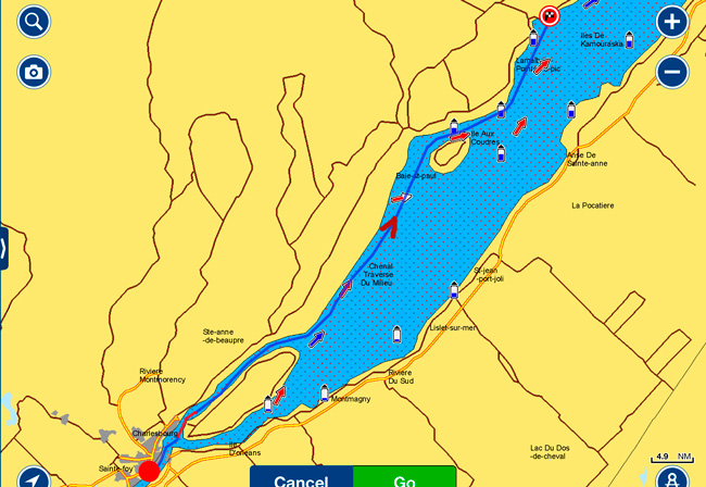
Quebec City to Cap-a-l'Aigle - 74 nm
Sunny and warmer today as promised. Left Quebec City after a great stay and making new friends. We had a long run today that had to be timed with the tides to take best advantage of the river currents. Failure to do so could result in a lot of wasted time and fuel to make the run. There are few opportunities to anchor or dock today as most areas along the shore where the depths would permit this dry out at low tide and our boat would probably not sit very well on its keel. The harbors often have only a couple of feet of water at low tide.
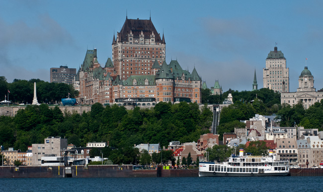
Au Revoir Quebec City!!
On our way past the Old Port, we contacted Symmetry II, who were just fueling up, to let them know we would see them later at Cap-a-L'Aigle(Eagle Cape). Past the short industrial section of the port of Quebec, we took the south route around the Ile d'Orleans with its rural landscape. Everywhere we went in the City, the produce came from this island - definitely the bread basket of Quebec City.
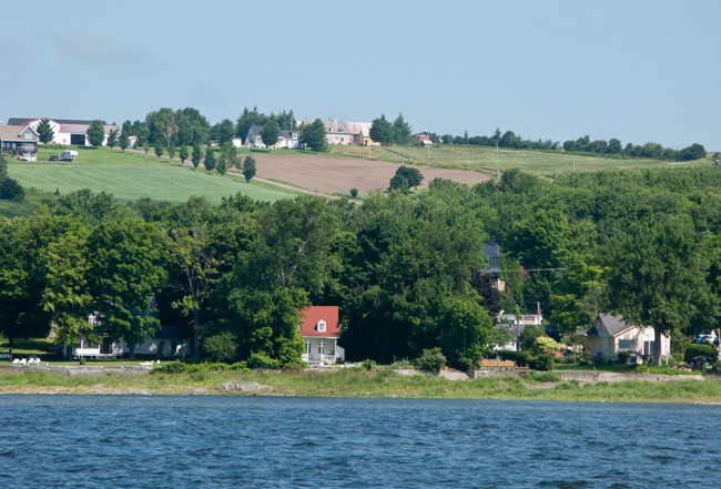
Small colorful villages dotted the shoreline along our route today with their ever-present churches. Some had inaccessible (for us) harbors; a shame as they looked very attractive.
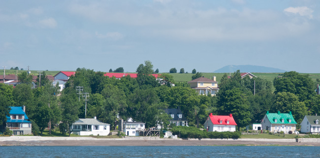
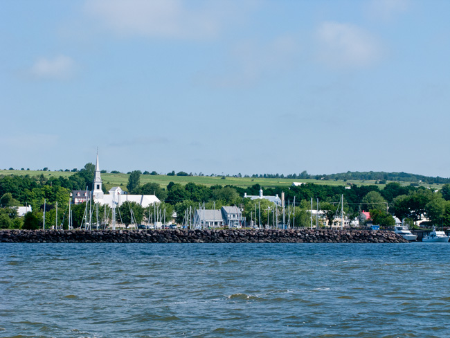
Typical Village With Its Church and Harbor
The mountains started to rise along the banks in the distance and our speed did as well as we were in the ebb tide flow making 6 knots more than normal - just flying along! These are the Laurentian Mountains that reach a height of 3800 feet northeast of Quebec City. They are one of the oldest mountain ranges in the world dating back almost one billion years. The Adirondacks in New York State are an extension of the Laurentian range.
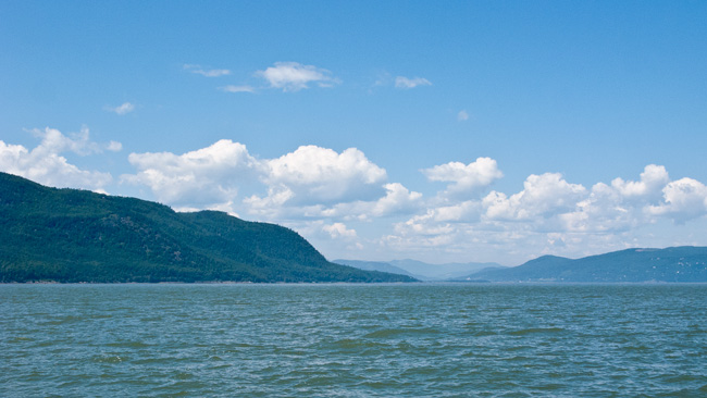
The Laurentians Ahead
The freighter traffic was particularly heavy today, also taking advantage of the current and we saw several running at 17+kts versus their normal 13.
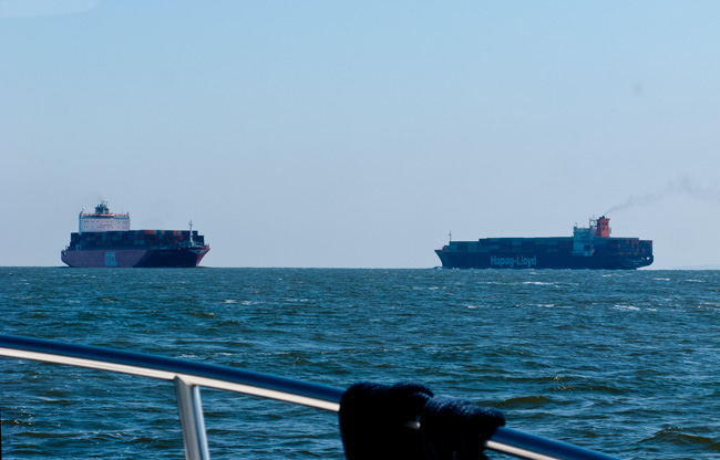
Just about 2/3 of the way into our run we ran our normal gauntlet of the ferries, catching two at once from opposite shores - we seem fated as far as ferries go and these were big ones!
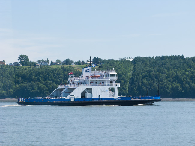
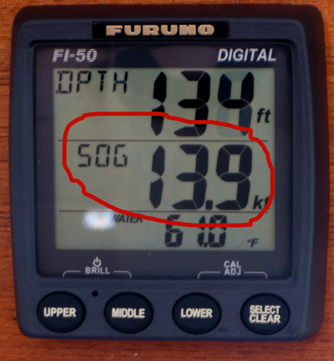
To add to the hassle of navigating around them and slowing down, we were also making our best progress today at high speed. We were making revs for our normal 8 knots but, over the ground, actually making:
In addition to the Tide Tables that are invaluable, giving the times for Low and High Tides at various locations along the tidal part of the St. Lawrence , we also use the Atlas of Tidal Currents that shows the currents at various locations and times along the River. The color and size of the arrow indicates the current direction and strength and allows us to be in the best position to take advantage of current. There can be a significant difference in just a couple of hundred yards!!
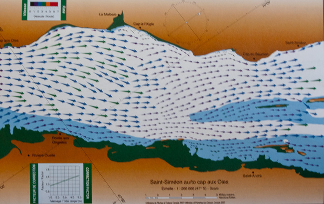
Extract From the Atlas of Currents
We timed it right and arrive at Cap just at low tide and got a good spot on a long dock with several other boats including an excellent restoration of a Lord Nelson Tug, "La Mere Veilleuse" (The Mother Pilot Light).
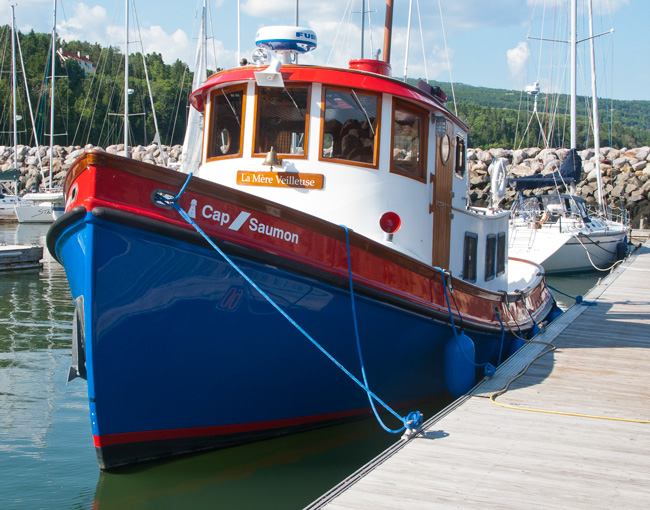
These are relatively rare with only 86 built in Seattle from 1988 to 1999. When we were looking for our previous boat, I was quite taken by a 37 in Georgian Bay but it had a BMW diesel engine and spares were obsolete. I was not looking for a re-power job in the future.
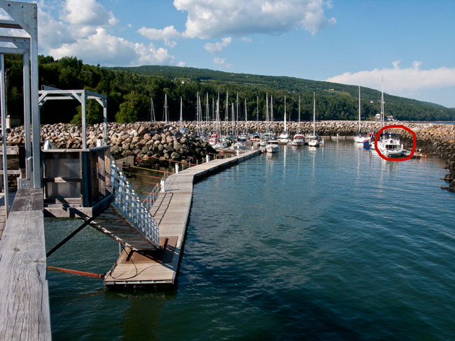
Cap-a-l'Aigle Marina
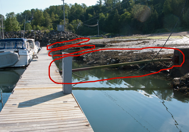
The trade-off for the good dock was a long hike to the office where little English was spoken. With my improving French, we made do and were soon signed up for the night with the bathroom and internet codes. Note the slope on the ramp to the dock. it is low tide now - at high tide, the ramp is level!! Each marina so far has had floating docks to accommodate the large tides and uses different systems to anchor the docks but allow them to move up and down. One common approach is to use long hinged poles, like below, but all power and water lines also have to follow the dock up and down.
Complicating the system, the docks are all typically uncoupled in the winter and rafted up in the middle of the basin. At the Quebec Yacht Club, it takes three weeks to move and re-connect the docks, water, and power in the Spring and the same in the Fall; the members all contribute the labor.
Had dinner at La Refuge Restaurant next to the office (very good food) and some good local beer. We had just ordered when Symmetry II with Jim and Linda came in, accompanied by their friends, Claude and Yvette, on Trusty III. We chatted with them for a while catching up on their experiences in Quebec before an early night.
Tuesday, July 12
We left Cap-a-l'Aigle at 10:30 am well after Symmetry II to take advantage of the ebb tide again but the first part of the run was on the slow side, i.e. less than normal speed for rpms due to adverse current.
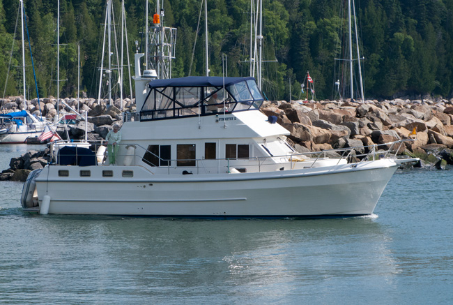
Symmetry II
We have found that The bible for the Down East Circle is a bit off on timing of departures in relation to the tides and a departure up to 2 hours after can often be better. On the way we, or I should say Judy, had our first whale experience, seeing two beluga whales in the distance. Belugas or white whales are relatively small at 10-16 feet long and are pure white. They are highly protected in the St. Lawrence and number around 500. We also saw a seal in the distance.....not a very good picture but it's tough to capture them while moving.
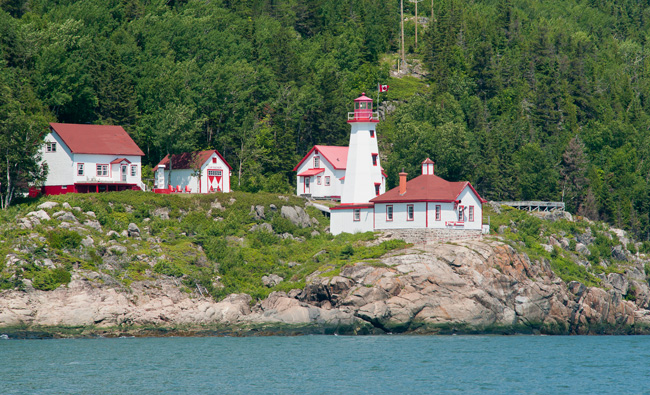
A very scenic ride close to the shore with numerous freighters passing by and a couple of picturesque lighthouses including the best looking:
The next lighthouse, at Prince Shoal, was a bit more utilitarian,very large, and very rugged sitting at the confluence of the Saguenay and St. Lawrence Rivers where we made the turn to go up the Saguenay River.
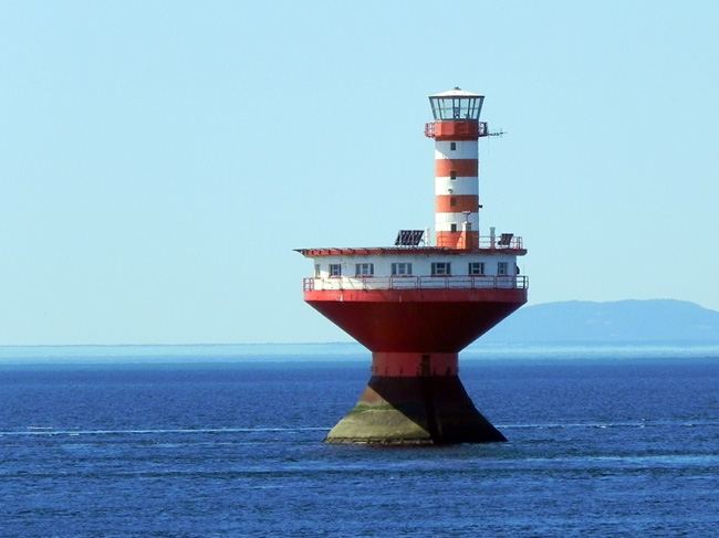
Prince Shoal Lighthouse
Our timing was a little off (we had followed the Bible) with very confused water: waves from all directions and strong currents for around 45 minutes. Not a good place to be when the weather is nasty! The waters calmed as we got past the river mouth and were greeted by the usual ferries. These were large boats carrying trucks from on side to the other to avoid a 100 mile detour around the Saguenay. While we had a "favorable current" we decided to keep going north about 20 nm to l'Anse- Sainte-Jean, a small village on the west shore of the River.
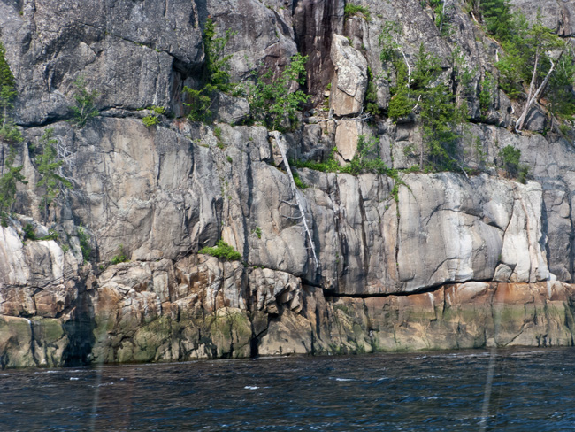
We were soon into the spectacular scenery of the Fjord with towering cliffs coming sheer to the water in many places.
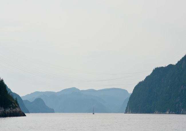
The View Ahead
The Saguenay River was used as an important trade route into the interior for the First Nations people of the area. During the French colonization of the Americas, the river became a major route for the fur trade. At the river mouth, the French established Tadoussac, France's first trading post in Canada, in 1600. They named the river for the legendary Iroquoian Kingdom of Saguenay.
Carved by glaciers in the Ice Age, the Fjord is very deep .... our depth sounder readings reached over 750 feet before becoming confused... and in many places one can travel just yards off the shore next to a 500 foot cliff.
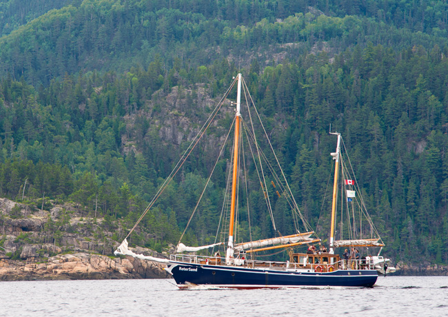
Le RoterSand
We were accompanied up the River by Le RoterSand, an 85' youth sailing school vessel that sailed from Hamburg, Germany last year to its new base in Rimouski on the south shore of the St. Lawrence. Over the summer, it will be making its way to Montreal.
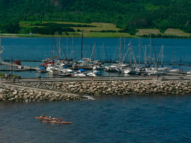
L'Anse-Sainte-Jean Marina
L'Anse-Sainte-Jean Marina proved to be a good spot tucked into one of the larger coves in the Saguenay that has good depth at low tide... there is not much choice of places to stay on the river. Anchoring in the river is very limited due to the deep water extending right to the shoreline.
Wednesday, July 13
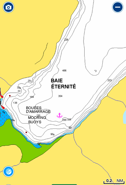
A Big Run from L'Anse-Sainte-Jean to Baie Eternite - 6 nm
Up early with a choice of where to go - Baie Eternite upriver and try to get one of the three mooring balls (slim chance from previous writers) and, if not, return to Tadoussac at the mouth of the river. The other choice was to just go directly to Tadoussac. We made the right choice as, when we arrived at Baie Eternite, they must have put in four new balls since the rest of the gang were here so there was plenty of space for us. In addition, it lived up to its reputation as the most scenic part of the Saguenay River flanked by Cap Trinite on the west and Cap Eternite on the east.
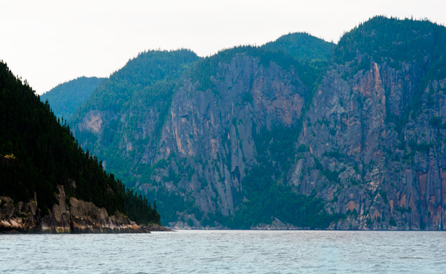
Entrance to Baie Eternite
The Baie is about 0.5 mile wide and 1.2 miles long but has over 800' of water at the mouth and 480' within 200 yards of the shore. Anchoring is not possible here due to the steep underwater profile of the bottom. To find a suitable depth to anchor would leave you no swing room for the tide. At one time, there were 20 mooring balls set along the shore but, over the years, many were dragged into deep water and lost by multiple boats rafting up on them. Parcs Quebec now has a program to add more mooring ball over the season.
A mooring ball is a large ball, usually plastic, with a vertical rod through it. The rod has a ring on the top and bottom. A line or chain is attached to the bottom ring and a heavy weight added on the chain/line to anchor it. We use a short rode from the bow of the boat, through the ring, and back to the boat. We had never used a mooring buoy before but had no problem. Much better than anchoring as we stay in one spot and swing around as the tide/wind changes and do not have to worry about swing room or cleaning the anchor as we pull it. Need more of these!!
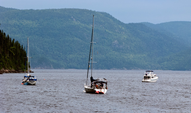
On Our Mooring
This was our first opportunity to test the dinghy out as we took a short ride to the Parcs Quebec dock just a quarter of a mile away....no problems, no water! In just a short walk, we were at the Parc office and were surprised by the number of people there but soon realized that there is a major campground in the area and a lot of tourists arrive by car. We decided to go for a hike up to the statue of the Virgin Mary located on the first plateau of Cap Trinite ... about 5 miles round trip.
The trail is rated moderate/difficult by the park authorities as the "rise" is consistent and shows its colors early on. After a short approach 0.4 km long along the water, the trail climbs steadily on rough stone steps, trail, some wooden stairs and rock for about 1000 feet and then descends 450 feet to the statue. It was a good workout!!
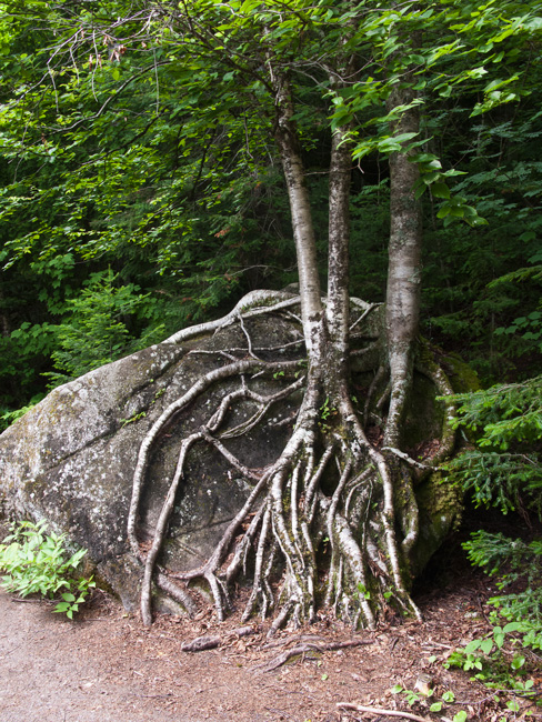
These Two Have a Tight Grip
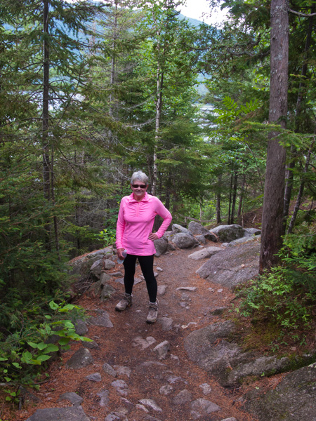
Bright, Eh!!
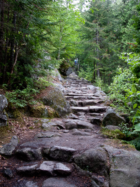
Long Stretch of Stone Steps
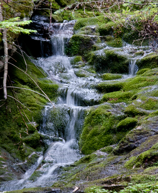
Just After the Rain
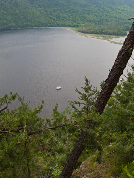
STB's Just a Speck Below
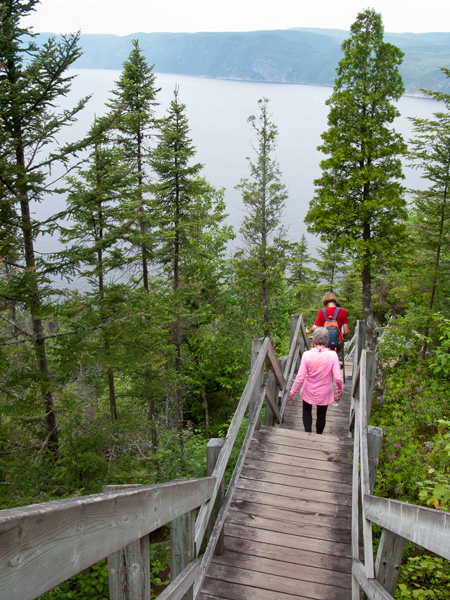
Ah! - The Downhill
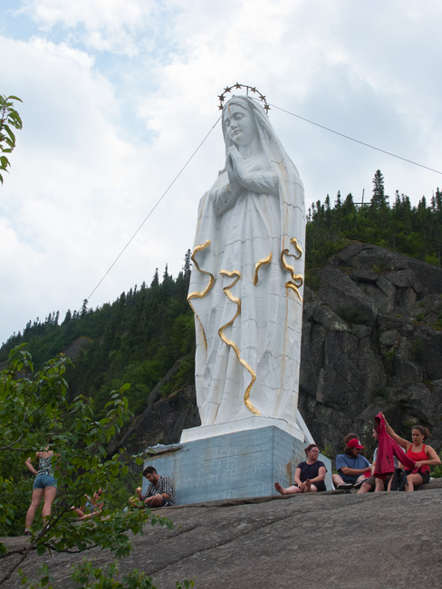
At Our Goal - The Virgin Mary
The statue of Our Lady of Saguenay was carved in honor of the Virgin Mary after the misadventures of Charles Napoleon Robitaille, a traveling salesman who, to get to Saguenay, had to follow the frozen River. One winter day, he was heading to the Lac Saint-Jean at the source of the River when the ice broke under his feet and he fell into the water; as a last resort, he asked the Virgin to come and save him. He miraculously found himself on the ice.
While we admiring the view, I noticed someone wearing a River Run T-shirt and asked them where they were from; turned out to be Grand Rapids, a short drive north of our home. They were on a road trip and just beginning their return.
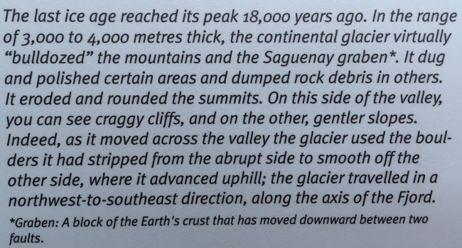
How the Saguenay Fjord Was Formed
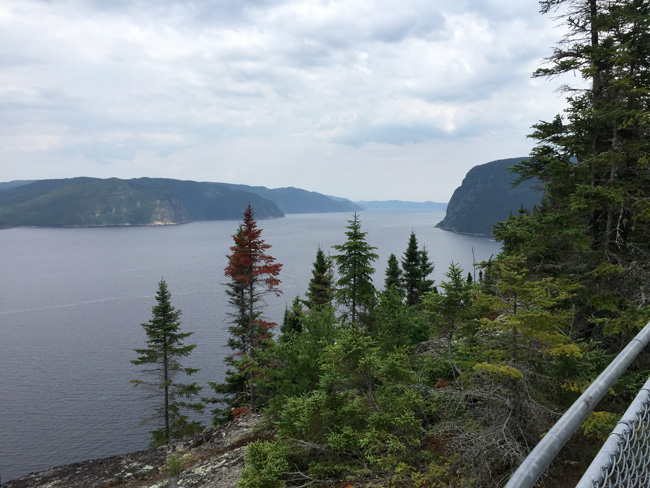
Amazing View from Cliff top to the Southeast
After the short climb back up to 1000,' it was all downhill. I don't know why that implies it's easier going as down is much tougher on one's body than climbing. We survived and celebrated with ice cream at the Office/store where we loaded up with T-shirts for the kids before heading back to STB for a quiet evening.
Thursday, July 14
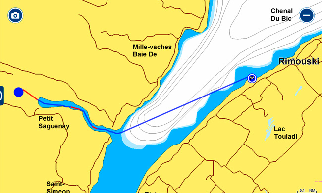
Baie Eternite to Le Bic Anchorage - 70nm
Left Baie Eternite just after sunrise for Tadoussac with the Saguenay Fjord wreathed in lines of fog.
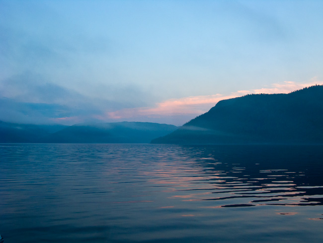
Sunrise Down the Baie
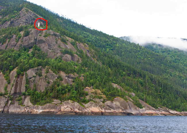
Where we Hiked to Yesterday
The views were getting better as we left with the sun reflecting off the fog.
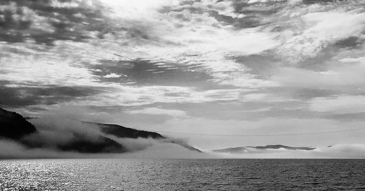
Against all the predictions in the Guides, we were on an incoming tide the whole way but had current of over 1 knot in our favor so we made excellent progress. No whales sighted along the Saguenay - disappointing.
Nearing Tadoussac, we passed Symmetry II and Trusty III heading up the Fjord fighting a current when it should have been in their favor. We reached Tadoussac at the right time and weather to cross to Rimouski and seeing, it was only around noon we went for it. If we didn't go today, we would probably end up staying another day or two due to changing weather.
Whale watching was slow again although we did see a couple of Minke whales as we got out into the St. Lawrence. Jim and Linda on Symmetry had to stop near Tadoussac since there were so many! Whale watching is very difficult as the population of the more common whales is not that large (around 10,000) spread over a large surface area. When they do surface, it's only for a few seconds at a time and seemingly at random locations; never enough time to capture it on the camera.
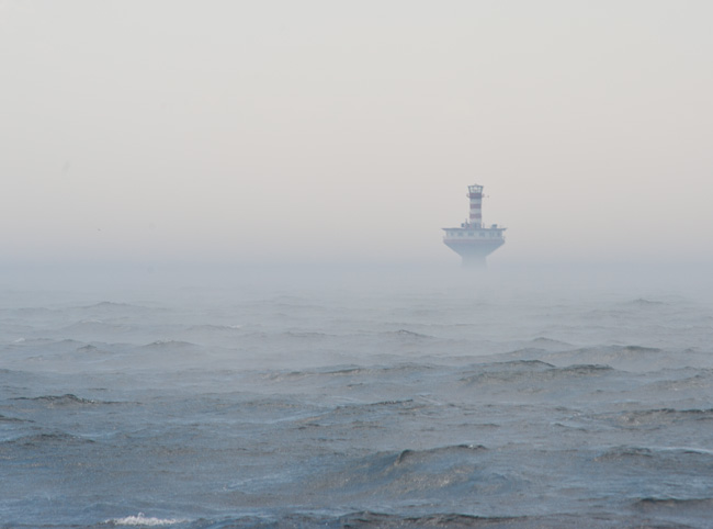
What a Contrast from Two days Earlier At the Lighthouse
As we reached the midpoint of the St. Lawrence, the waves were just off our stern quarter and we were rolling quite well. At that point, a squall warning was issued for the Saguenay River and beyond. Rimouski on the south shore was still a possibility for us, but careful tracking on the weather radar showed it was not going to be - it would arrive at the same time as us; not a good thing in a strange harbor. We'd already checked out our options and there was an anchorage at Le Bic with good protection in reasonable depth.
A race was on to get there before the storm hit. We had just set the anchor in 14' (at low tide) and got back inside when it hit with a wall of rain, winds and lightning pounding us. We saw just over 40 knots of sustained winds for about 20 minutes and the worst was over although the rain continued but lighter for the next hour.
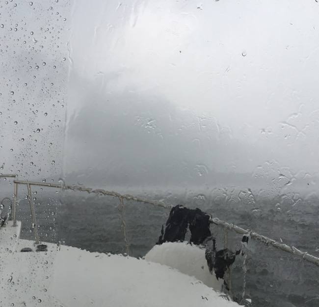
Where Did the Land Go?
We did get to see a harbor seal up close when we were out in the stern cockpit as one bedraggled example popped to the surface 10 feet away, looked Judy straight in the eye and dove down. He surfaced a couple more times before heading off.
Just a little south, in Maine (yes it's that close), they had 60 mph winds from the same storm line. The rest of the gang at Gaspe, a long way east, had the remnants of the storm later in the evening.
Things calmed down by dusk and we looked forward to a good night's sleep after watching a spectacular sunset to the NW with the remnants of the storm clouds. Little did we know .......
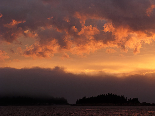
Flames in the Sky
Friday, July 15
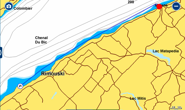
Le Bic to Matane - 60 nm
We have another long day to whittle away the distance between us and the rest of the gang and would like to reach them before Prince Edward Island. Up at dawn and took off in reasonable (15 kt. winds) and 2' waves behind us; the forecast was for increasing winds later but not too bad. We should know better by now.
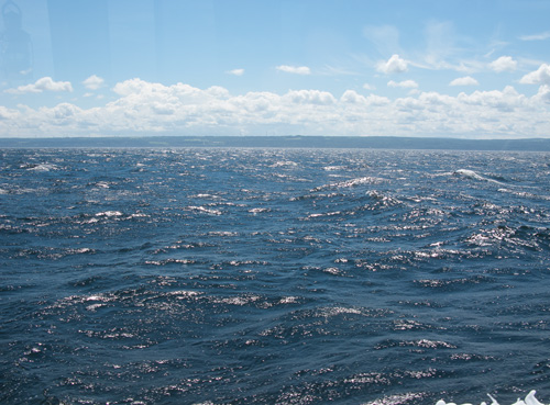
Early in the Day
Suffice it to say it blew up to 35kts and waves were at least 6' by mid day. We had no alternative ports on the way so just hunkered down and let the autopilot do an outstanding job keeping us on course. We ran at 9 knots but when we saw 14.5kts surfing down a couple of waves with the whole boat shuddering, prudence kicked in and we slowed to 8kts but still regularly saw 13kts. Several times, the autopilot kicked in 20 degrees of rudder as we went sideways from an offcourse wave - way faster than I could have reacted.
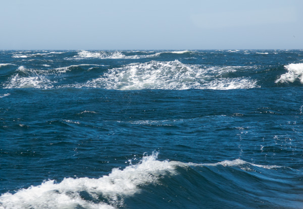
Late Morning
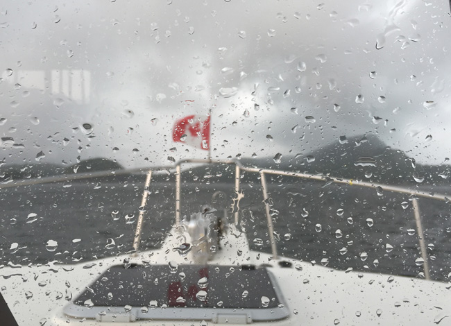
Early Afternoon
Not a moment too soon, Matane came into sight and we shot into their long channel (much like we have on Lake Michigan but narrower) on 4' waves until we made the 90 degree turn into the marina. Luckily the tide was reasonably high so we had no depth issues but we were a bit concerned with the low spots in the waves. We don't know why, but they insisted we go into a slip with 35 kt. winds taking us off the dock. Needless to say, docking was a nightmare with 4 lines to the dock, working our way in a foot at a time.
We did not venture far from the boat but were not too impressed with Matane - the fact we couldn't stand up probably didn't help and the docks were like a roller coaster.
Saturday, July 16
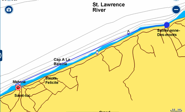
Matane to Sainte-Anne-Des-Monts - 46nm
What a difference one night can make - the wind died overnight and we awoke to a cool but sunny morning. All was peace and tranquility in the marina.
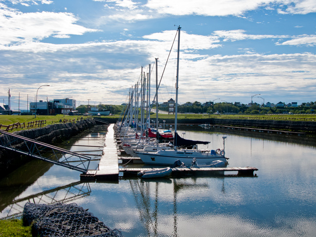
All Sailboats Here
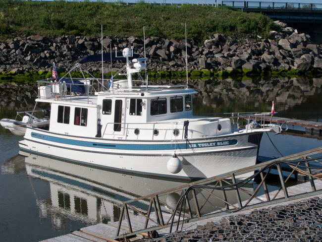
We Were Segregated With the Dinghies?
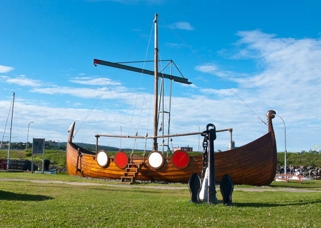
The Matane Viking Longboat
The 37' longboat, Le Knorr, was built in Les Mechins for Matane to mark the 450th anniversary of the voyages of Jacques Cartier. The boat represented Matane at celebrations in Quebec City and Montreal. It recalled the voyages of the Vikings who were the true discoverers of Canada. Didn't the First Nations discover it?
The tide cooperated with our departure and we had sufficient depth to leave the marina by 8:00am. In the midsummer, departures very close to low tide are still possible as low tide is 2' above datum. At other times, they recommend closer to mid tide if you draw 5'.
Out on the water, it had calmed since yesterday with a slight swell remaining but from the north which made it a little rolly. Whale watching was a little more successful with three Minke whales sighted. Minke whales are 25-30' long and quite abundant; they are usually seen singly or in pairs.
Passed a milestone today; reaching 7,000 nm on Sir Tugley Blue.
Along the route near Cap Chat, we saw our first boat in two days, a freighter heading across the River (now about 35 nm) - lonely out here....
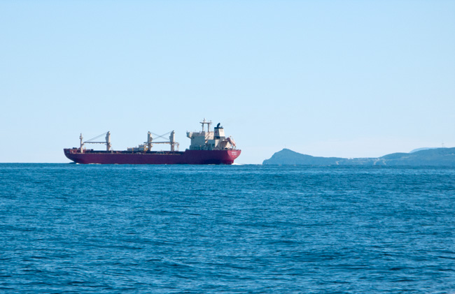
Cap Chat in the Background
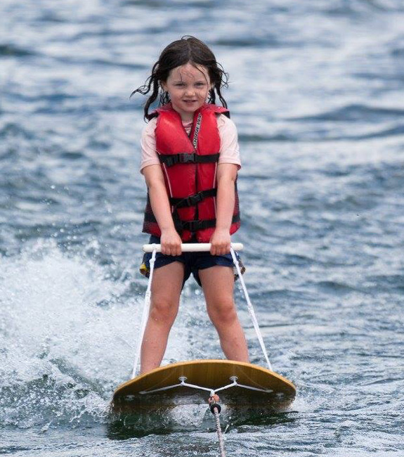
Shortly afterwards, Cap Chat came clearly into view with its extensive windmill park with over 130 wind turbines including the world's tallest vertical axis turbine (like a 360' eggbeater). We also received a photo of our grand daughter, Morgan, up for the first time on beginner skis:
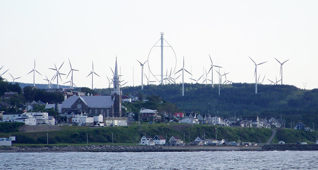
Le Nordais Windmill Park
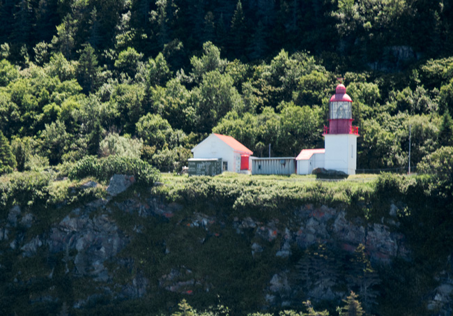
Cap Chat Lighthouse
Just 7 nm further on we reached our destination for the night, Sainte-Anne-des-Monts, and we were welcomed to a straight-in dock - we liked that.
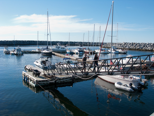
Sainte-Anne-des-Monts Marina at Low Tide
Here we were deep in to French-speaking country with limited English spoken .... my French is starting to come back and I can put a sentence or two together and make myself understood. Only 0.1% speak English as their first language and not many more are bilingual. Even with the language barrier, people were so friendly and went out of their way to talk to us.
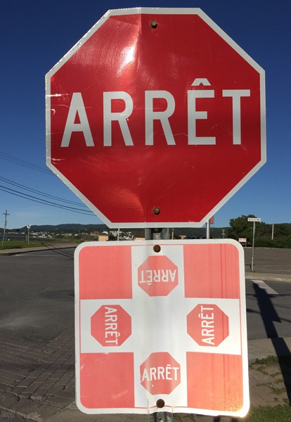
Definitely Not Bilingual Here
Sainte-Anne has a small fishing port adjacent to the recreational marina and they did have a few commercial trawlers in port but at least 30 people were fishing on the pier with several RVs and campers right on the dock for the weekend.
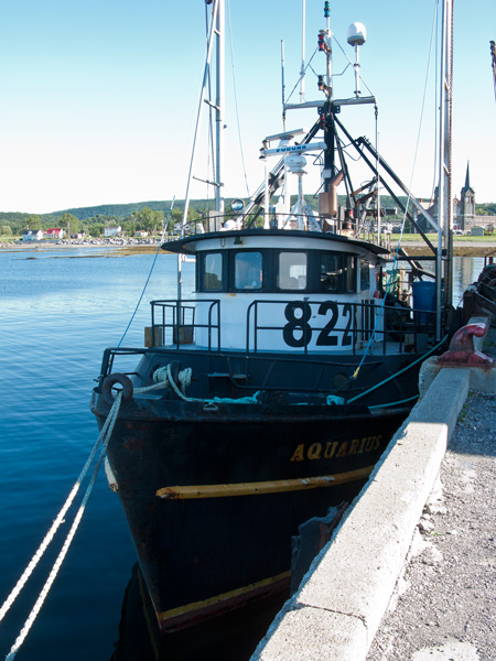
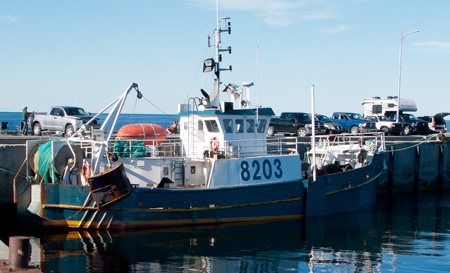
Sainte-Anne is a decent size compared with some of the smaller ports along this coast with a population of almost 7,000. Its economy is primarily based on fishing and tourism with the Chic-Choc Mountains in the background and the Gaspesie National Park beyond them. Unbeknown to us, our son had been to Sainte-Anne about six years ago on a backcountry skiing trip when he lived in Maine and was quite familiar with the area. We were pleased to see a good supermarket and took the opportunity to stock up as it had been a while since Quebec City.
Commensurate with its size, Sainte-Anne has a very large, twin-spired church that is a clear landmark from way out in the River.
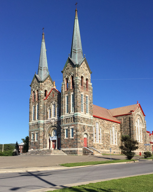
Church of Sainte-Anne-des-Monts
Based on recommendations from the gang ahead of us, we ate at the unassuming restaurant just behind the marina and were treated to an excellent seafood dinner - go there if you are in the area!
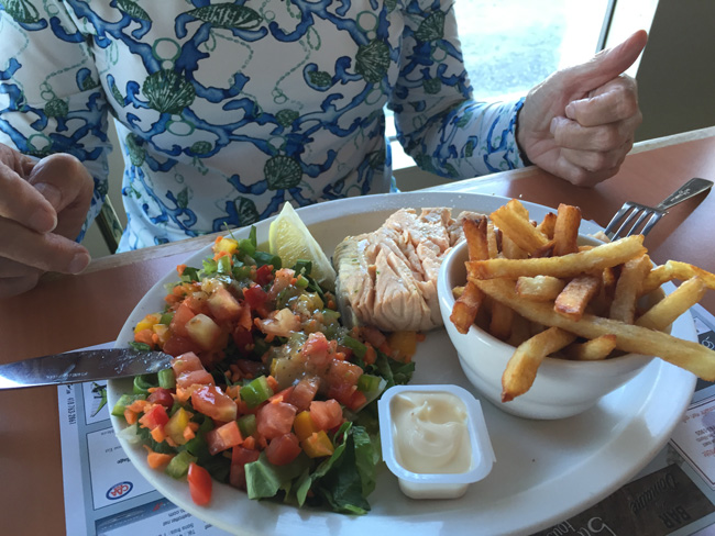
A Great Halibut Dinner
Scattered around the marina and the Aquarium were a number of sculptures and interesting items like the one below:
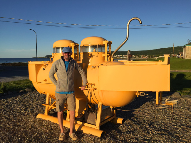
We Would Not All Live in This Yellow Submarine!
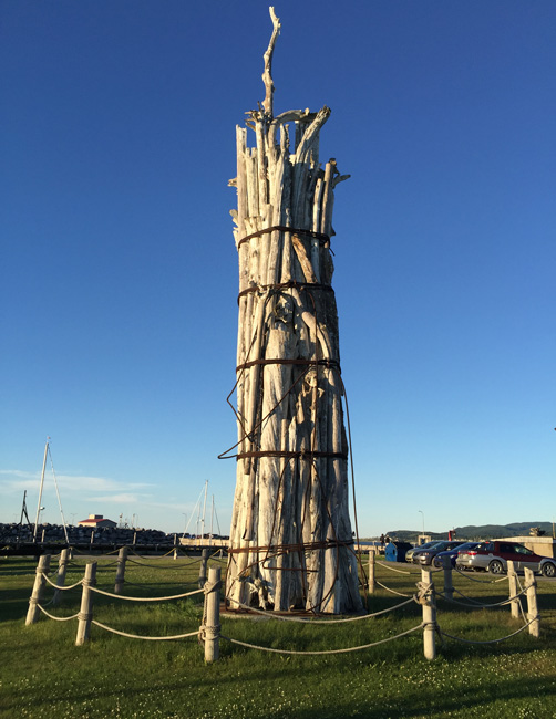
Drapeau Blanc - My Statue of Liberty
During our stay, we were entertained from arrival to bedtime by two singers across the marina who performed from 3:00 pm with just very short breaks. They had recorded backing music but sang everything from hard country to folk and pop, mostly in French but with the occasional English lyrics. Excellent voices. We later found out it was the Mackerel Festival and, by early evening, a crowd of locals had gathered with their barbecues in the pickups and cases of beer and food. By 8:30 there was quite a celebration going and the burning barrels dragged out and stuffed full of long lengths of driftwood. No firelighters here, just a gallon of gas over the wood and a long stick/rag to light it....guarenteed to burn!
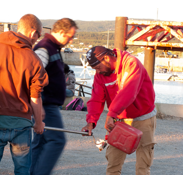
Rather Him Than Me...
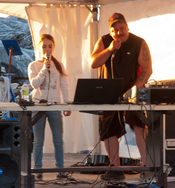
Amazing Singing from a Young Girl in the Audience
As we were listening to the music and talking, a young woman with her daughter came up to us and spoke to us in excellent English. She must have been the 0.1%. It turned out that Valerie and her daughter Juliette, had moved back home recently after living for ten years in Montreal with her partner, having inherited her parents' home. She had worked in Social Services in Montreal and had just found a job in the town by luck as much as anything. We spent over an hour talking to her - think she was needing to speak English to someone!
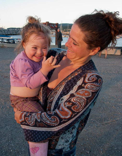
Valerie and Juliette
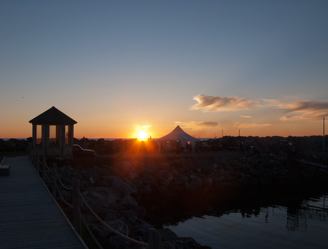
End of Another Great Day
Sunday, July 17
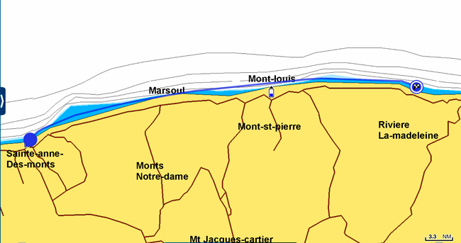
Sainte-Anne-Des-Monts to Riviere-La-Madelaine - 48nm
Cool night so we slept well with the temperature at 56 deg. F early this morning but sunny with very light wind. The forecast looks good for the rest of the day and for the next couple. When we were on the water, we hmm'd and aah'd about our destination for the day; Riviere-La-Madelaine looked a sure thing at just less than 50 nm with Riviere-Renaud around 85 nm, but it would be a long day. Also Renaud would only give us a 32nm run to Gaspe tomorrow where we plan to spend two nights.
The trip was very pleasant, running a half mile offshore in 150' of water, with the Chic-Choc Mountains dropping steeply to the shoreline. They are a narrow band of mountains that are an extension of the Appalachians, approximately 60 miles long and 6 miles wide. The Chic-Chocs are heavily eroded, with rounded, flattened tops and steep sides. Over 25 mountains in the range have peaks higher than 3,300 ft; the highest is Mont Jacques-Cartier 4,160 ft, the highest in southern Quebec. The area is popular for backcountry skiing.
Close to the shore we were getting up to 1.5 kt of current in our favor - good for diesel consumption!
Every few miles, at a small river mouth, we spied small villages with their prominent church spires. Some of these were settled as early as 1697, with subsistence fishing their only occupation until logging began.
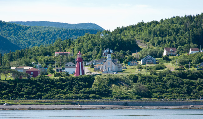
La Martre (pop. 245)
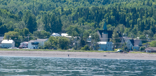
Marsoui (pop. 309)
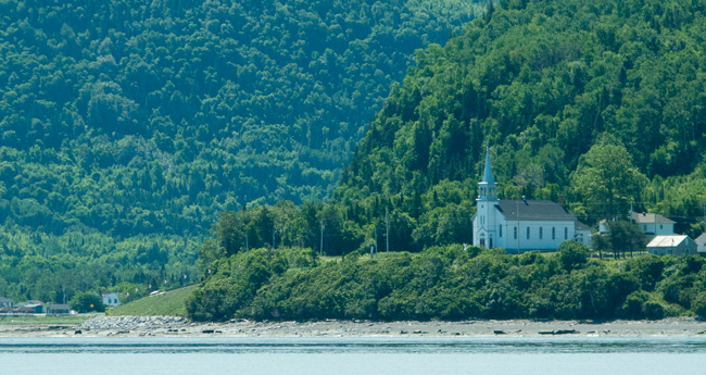
Too Small to Have A Name But It Has Its Church
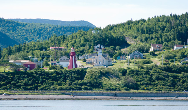
La Martre (pop. 245)
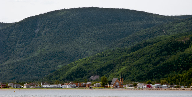
Mont-Louis (pop. 1100)
The rest of the ride was uneventful in very flat water with changing mountain scenery. Very much like cruising along the east shore of lake Michigan with trees instead of sand dunes.
Just past Mont-Louis, we reached a milestone in our journey, probably the furthest north we will see, at 49 deg. 14.72 min.North. We are now around 100 miles east of the most easterly point in the USA. To give some perspective, home lies at 42 deg. 12 min. N, so we are 7 deg. 2 min or 422 miles north of Portage. Going due north from home this distance, we would be past the northern shore of Lake Superior. A major part of the US/Canadian border lies on the 49th parallel. Sunrise is now around 4:35 am and sunset at 8:20 pm. We are not used to it getting dark so early in the summer with sunset at 9:20 pm at home. We rarely see or want to see sunrise this early although it helps visibility on the early morning trip to the head.
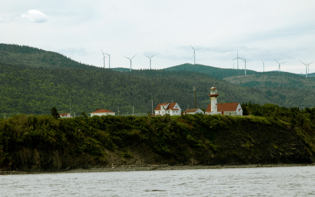
The Riviere-La-Madelaine Lighthouse
On arrival at St-Madelain- de-la-Madelaine Riviere (a mouthful), someone was already waiting to take our lines; straight in to the first dock - doesn't get any easier says Judy! This is a beautiful little marina with several small sailboats, a number of small <20') fishing boats, and couple of small cruisers. We were the biggest boat there. Great wide, sturdy docks with 15A power and a 500' hose to reach our dock right at the end. The village is celebrating 100 years as a municipality in 2016.
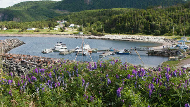
This is the most informal marina to date with just a book to write down the boat details and the cheapest rate yet - $1 a foot. The marina is managed by Joel Cote who is also the mayor, the restaurant owner, tour operator, and teacher in his spare time! Everyone we met were so friendly and could speak some English; with my limited French (which is getting better as we go) we managed to communicate quite well.
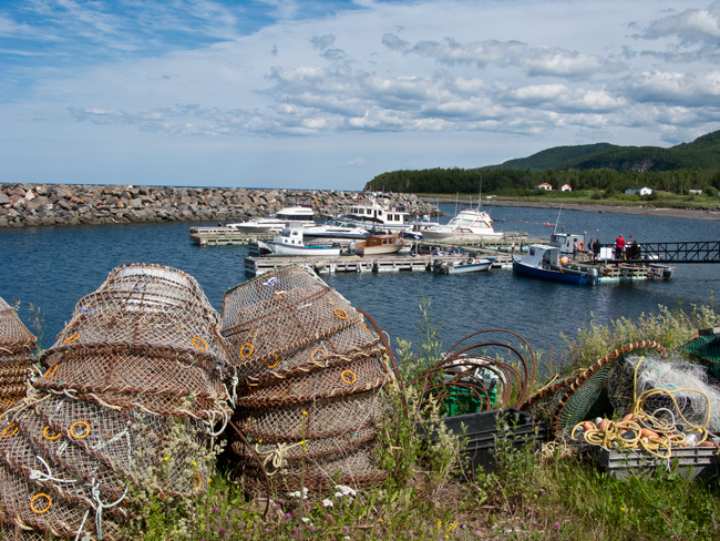
Fishing Is Still an Active Occupation Here
We were going to walk to the lighthouse but didn't make it - a little further than described but we did see most off the village which is extremely well maintained with some beautiful flower gardens. It must be a prime summer for them as the temperatures have been higher than average.
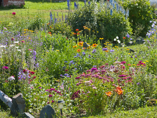
One of Many!!
As we reached the end of Riviere-La-Madelaine, the last building of any significance was the old General Store, now owned by artists Jacky Georges Larfague and his partner, Louis Couturier, who have remodeled the store as a home/artist workshop. They have organized an exhibit by three prominent Canadian visual artists that is being shown for the rest of the anniversary celebration. We watched one. of the exhibits, a collage of video sequences from around the Riviere-La-Madelaine area and Gaspesie interposed with stills. It was shown, with music in an old semi trailer (think cheap cinema). It wasn't something you would expect to see here - more likely at the Montreal Museum of Fine Arts. Evening outdoor showings of other video work are also scheduled. Jacky and Louis are also instrumental in digging up and documenting some of Madelaine's past; excavating parts of the old paper mill on the river and the buried locomotive that hauled paper to the wharf.
From here we walked back along the beach as the tide went out. Partway, we met a resident who retired here from Montreal and had a long chat with him.
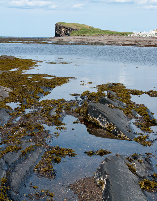
View Back to Cap Madelaine
On arriving back from our beach walk, I struck up a conversation with a guy on a very small "fishing type" boat next to us. It turned out that Claude was not a local (from Quebec City) but has his own video production company producing films for French TV and his own company that shows documentaries at retirement centers in the winter. He is currently working on a film of the Gaspesie area, traveling place to place. We spent an hour or so talking about the area and his work. In four weeks, he is heading north about a 1000 miles to Baffin Island (but not in his boat) to film a documentary on polar bears. He has spent many months in that area and knows it well.

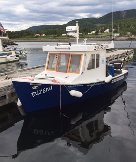
Claude and the Buj'eau
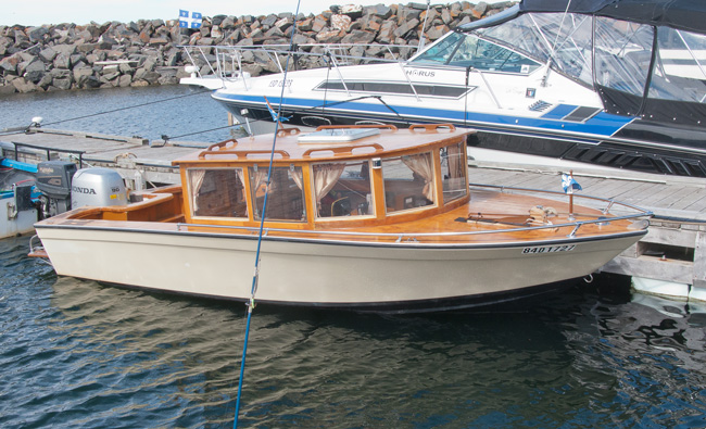
The Deluxe Fishing Boat
A quick shower later, we were off to the "Captainerie", the restaurant by the marina which is run by Joel, for an excellent meal. Although it was a Sunday night, the place was packed and overflowing to the tables outside. Reservations are a must here in the summer. Joel said they had been busy since their breakfast opening with many tourists enjoying the Gaspesie area.
The boat continues to attract a lot of attention wherever we go; we have given out a lot of boat cards, and have spent many hours talking about our trip. We have now spent nearly 10 years cruising each summer and it has become a way of life for us. Even this trip, our longest ever, seems to us to be just the next evolution, and not extreme. Many we meet find it hard to comprehend that we have come this far by boat, assuming we have driven here, which in itself would be a good trip. It seems they don't get many US "tourists" in the area by boat.
While Judy retired to the "her room", the guest cabin, to read, I wandered down to the beach under the cliff to watch the sunset. The cliff rises sharply at about 40 deg. to the surrounding land and is comprised of layers of slate-like rock varying from 1/8" to over a foot in thickness. Interspersed between many of the layers of the dark rock are very thin bands of quartz. Obviously harder than the slate, they have not eroded as much so there are many microledges of the white stone.
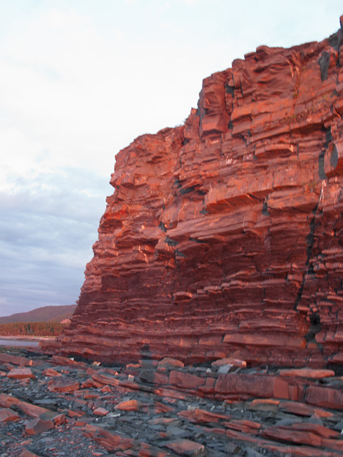
100 Foot Slate Cliff Reflecting Sunset - Amazing Colors
They have some spectacular sunsets along the St. Lawrence and tonight was again one of the best. I probably shot 50 photos at varying stages; this is just one of many.
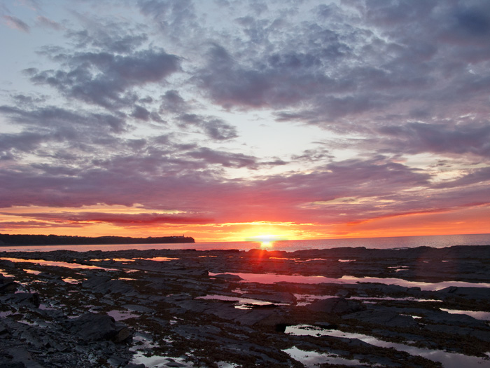
Whale watching today was a little better with at least three sightings, all Minke whales, plus a seal.
May 16 - 22 |
May 23 - 29 |
May 30 - Jun 5 |
Jun 6 - 12 |
Jun 13 - 19 |
Jun 20 - 26 |
Jun 27 - Jul 3 |
Jul 4 - 10 |
Jul 11 -17 |
Jul 18 - 24 |
Jul 25 - 31 |
Aug 1 - 7 |
Aug 8 - 14 |
Aug 15 -21 |
Aug 22 - 28 |
Aug 29 - Sep 4 |
Sep 5 - 11 |
Sep 12 - 18 |
Sep 19 - 25 |
